This area of Ontario – Dufferin County and adjoining regions – has dubbed itself “Hills of Headwaters” with various related terms (Hyland, Highland, Heights, etc.) in the names of businesses, schools, parks, and associations. At first, the term is awkward, somehow. Hills and Headwaters seem to be unrelated words that have been artificially stuck together, but the combination makes sense. There are hills, to be sure. In fact this is the province’s height of land. And there are headwaters. The only way water can get here is up from the ground or down from the sky. There is no higher place for it to flow from. And it does flow.
Rivers in the Hills
This is the source of rivers flowing into Georgian Bay (Nottawasaga River), into Lake Ontario (Credit and Humber rivers), into Lake Erie (Grand River), and into Lake Huron (Saugeen River). There may be some question about the Saugeen but, as I recall, my topographical map shows at least one faint blue line inside the western boundary of Dufferin County connected to that flow.
Uphill from each of these rivers is a web of streams, rivulets and unnamed creeks flowing through culverts and under bridges along the back roads.
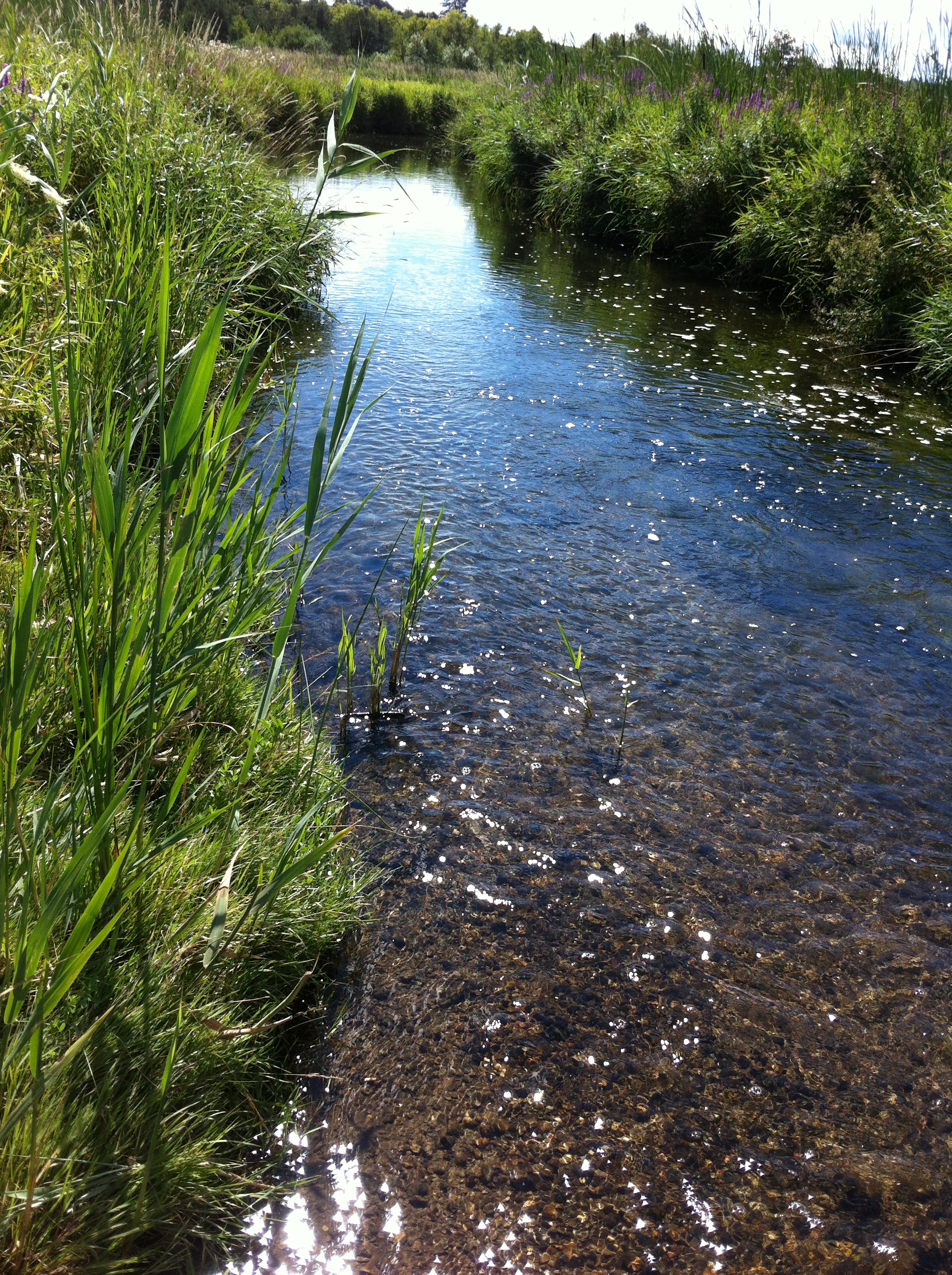
The Boyne River from the bridge on Highway 24, just north of Highway 89

This little stream begins in trickles from the valley walls and flows into the Pine River.

Even in late summer, the water continues to flow, clear and cold.
Trace them back and they all begin in a spring bubbling up from the earth, or a little flow tumbling down the side of a hill. In various places at the tops of hills, or partway down the slopes, people have dammed little streams or dug out ponds that seem oddly out of place. Ponds should be at the bottom of hills (Maybe Jack and Jill climbing the hill to get water is not so illogical after all). There are wetlands – great sponges that soak up the rain and snowfall, where beaver and waterfowl thrive, and red winged blackbirds nest among the cattails. There’s a good sized one just west of Orangeville on Highway 109, at the turn to Laurel, and of course the whole area surrounding Luther Marsh is one of the largest in the area.
When the trout season opens, parked cars by the roadside show that fresh, cold rivers are nearby – where speckled and brown trout live, or where the rainbow trout move upstream from the Great Lakes to spawn.
Where Does All the Water Come From?
Much of it begins with the Niagara Escarpment. Thousands of years ago, a retreating glacier pressed all its weight down on the western edge of a large plate of land, pushing it down. The eastern edge of the plate raised up, creating the Niagara Escarpment that follows a scribbled line from upstate New York, across the border at Niagara Falls, arcing through southern Ontario and along Manitoulin Island at the top of Lake Huron/Georgian Bay. The height of this land is right here, in the Hills of Headwaters. The actual highest point is just outside Dufferin, in Grey County. The effect of the retreating glacier was amplified a bit near Dundalk, possibly the result of the Dundalk Dome. That is a geological feature under the ground, not the ice rink in Dundalk, Ireland.
Today, and for millennia past, moist air blows from the south, and flows up the slope of the escarpment. As it rises into cooler air, its moisture condenses into rain or snow that falls at the top. Of course there are also storms that bring the moisture from the Pacific, or Gulf of Mexico – nor’easters and Colorado lows and Alberta clippers. Most of the water comes from the sky; the rest is from underground and the Escarpment plays a role in that, too. The fissure and cracks, where the earth’s plate split, extend deep into the earth and form direct links to underground streams and aquifers.
In Mono Cliffs Park, north and east of Orangeville, just below an escarpment cliff there’s a shallow pond. It doesn’t look like any water is flowing into it but it is flowing out, a little stream trickling down the hill. The water is seeping up from somewhere deep below and the little flow is joined by many others, eventually finding their way into the Nottawasaga River and Georgian Bay.
Island Lake, just on the outskirts of Orangeville is the primary source of the Credit River. It begins in little springs uphill from and under the manmade lake and flows in a south east direction, pretty well straight, for a river, down to Port Credit. On the way it takes a few falls and cuts through a deep valley at Cataract. This was a canoe route for first nations people. Their name for the river was Missinnihe, “trusting creek”. So called because they used to meet European fur traders and the mouth of the river (Port Credit) to trade furs.
Another river that begins here is just north and a bit east of Shelburne. As you drive into Horning’s Mills off highway 24, there’s a small house on the right side with what used to be the concrete ponds of a fish hatchery in the front yard. Up behind the house is another spring-fed pond. From here the water flows under the road and down the hill to another large pond and into the Pine River that also eventually winds up in the Nottawasaga and Georgian Bay. The valley in flows through, from Horning’s Mills to Terra Nova offers some breathtaking views. The Boyne River also rises not far away, flowing through another deep valley just north of highway 89 also making its way into the Nottawasaga.
Near the northwest corner of the county, the Grand River rises near Dundalk, just outside Dufferin but there are many other streams within the county that contribute to the flow. It wanders through Dufferin, in places switching back on itself, down past Elora and Guelph, through Cambridge right down to Lake Erie. At the time of this writing (early spring 2014) the Grand is still mostly frozen. The day the ice breaks up is awesome.
I used to live right beside the Grand in a little village called Waldemar just north of Highway 109. In the spring we’d stand on the bridge to watch the ice floes. Every once in a while a large chunk of ice would smash into the bridge support and there’d be a deep thrumming sound that’d stir us deep in our souls. In fact, even sitting in our living room, you could hear the water rushing by and the deep impact of ice floes.
Upstream, at Grand Valley, the river often floods, particularly when the ice is just breaking up. The Grand has been flooding since long before Europeans arrived here. The first people called the river Pesshinneguning, “the one that washes the timber down and drives away the grass weeds” and planted their corn on the fertile flood plains when the water returned to its banks.
When the Europeans Arrived
The early settlers in the Hills found ancient forests to clear and rushing rivers to harness… many of which had a lot more water than what they carry today. The Pine River at one time had enough flow to carry logs down to a sawmill at Terra Nova, at least in the spring. What’s more the Pine River carried enough flow year ’round to power several mills. The book “Into the High Country” by Adelaide Leitch and published by the Corporation of the County of Dufferin in 1975 discusses many different rivers that were powerful enough for mills and this technology was vital to the development in the area. The upper reaches of the Humber and Credit Rivers, a tributary of the Pine called Little Wonderstream, the Grand River at Waldemar, Sheldon and Rookery Creeks, and the Boyne all powered mills. And there were many more – in Orangeville, Mono Mills, Erin and Alton for instance. The Alton Mill on Shaw’s Creek is one of the few still standing, and still in use as a haven for artists and a stunning location for weddings and such.
As technology grew through the turn of the 20th century, so did ambition and the flow of water was harnessed for other reasons. In the early 1900s Horning’s Mills, Shelburne and parts of Orangeville had electricity from a direct current generator on the Pine River. It was built with the backing of Sir Adam Beck. The generator on the Pine shut down in 1923, the year after the Queenston-Chippawa Hydroelectric Plant started rolling at Niagara Falls. That generator was renamed for Sir Adam Beck in 1950.
Today, the flow of these rivers has waned, but they can still be raging torrents in the spring, and through the summer, many are still cold and fresh enough for speckled trout to thrive.

Nice commentary and history of the area and each river. Thanks !